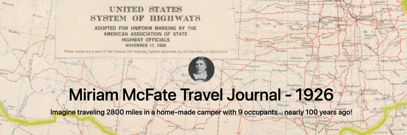
The following text is taken from a transcript 1 of my grandmother Miriam’s original journal.
This abridged Rootstalk edition of the family’s travel ends on November 5 as the family passes from Missouri into Arkansas. Their travel through Arkansas, Texas, New Mexico and Arizona has been omitted from this version of the text to better manage the length of the article. The daily transcript resumes on November 24 as the travelers pass from Arizona into California and the last days of their journey west.
Content has been sparingly edited for clarity – mostly things like placenames and probable transcription errors – and presentation.
The full text of the original transcript, with minimal edits plus additional insights and updates, can be found at https://1926.mcfate.family, and a searchable McFate family tree is also available as part of https://tree.mcfate.family.
Foreword: Resourceful and Perseverant
I remember my father as the consumate DIYer, a genuine Jack-of-All-Trades, and master of many! Having read grandma’s journal many times I see his skills and spirit were inherited, and passed on to me – albeit with less mastery. Whether that’s a good thing or bad in my case, and in these complex times, I’m still uncertain.
The McFate family, like so many others “back in the day”, was resourceful. Perhaps a testament to a simpilier time? Certainly a quality that served them well in both daily life, and as they ventured forth.
When compiling this text, and preparing content for https://1926.mcfate.family, I counted 53 entries mentioning breakdowns – and subsequent repairs – related to tires, wheels, oil, electrical systems, and the engine of their Ford. They overcame all these things without significant assistance from others.
They were clearly perseverant, averaging 75 miles per day over 35 days of travel - a 9.4 MPH moving average - while managing to feed themselves (and others), shooting game near the roadside when it was acceptable to do so. They prepared most of their own meals, setup and broke camp 34 times, and even crafted simple toys for the kids to keep them occupied. Grandma had a hand in all of this while observing and recording innumerable details as you will see in her writing.
They were remarkably resourceful and perseverant, necessities of a simpiler life in a simplier time, and I envy that.
With the auto route traveling west, in a house built on a Ford with all modern convenience of camp life. Our house is equipped with a gasoline stove for cooking, a small wood heater for heating, 1 small medicine cabinet, with all necessities of a young hospital. Folding table and chairs, 1 day bed, used in day time as a seat and a place for our bed covers, when not in use. One cupboard and all cooking utensils including a pressure cooker. We fasten tent and camp cots on outside.
All in all we have a very comfortable way to travel. Not too fast but just fast enough for the most enjoyable time of our lives.
Following you will find each day’s drive as we journey on.
The family traveling west:
Miriam and Clarence McFate
Grover Tahash (brother of Miriam)
Mildred - age 14
Kenneth - age 12
Velma - age 8
Delmar - age 6 (the author’s father)
Beulah - age 4
Jimmie the dog (and later on, Dallas, a terrier pup)
Monday, October 18, 1926
“Bid all good-bye.” Left [home, in Sheridan Township, Poweshiek County, Iowa] at 1:47. Drove to the River-to-River Road and pulled to the road side 2 to wait for Clarence, who had gone into Grinnell. Built the fire as it was cold. Kept real comfee. Waited 1 hour. Soon got the move. Stopped at Victor for gas and oil. Got our groceries. Left Victor at 4:25. Drove to Ladora, Iowa. Pulled onto a free campground. Got our supper and went to bed. Did not use the tent. All bunked together. Pretty near the [railroad] track, so didn’t really enjoy our rest. Has been cold and cloudy all day.
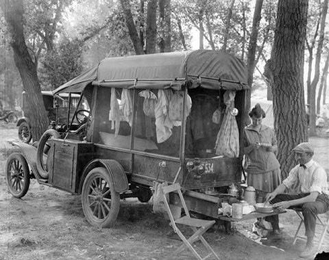
This 1926 image from https://www.modeltcentral.com/model-t-ford-campers.html is NOT a photo of the McFate party, but it depicts somewhat how I imagine they traveled and camped along the route.
Tuesday, October 19, 1926
Got up at 4:00. Got breakfast and ready for the road.
Started at 5:45. Just daylight. Had to detour south of Marengo. Had trouble with an oil leak. Drove through 3 a very hilly stretch of country. Detoured from Marengo through Williamsburg on to Iowa City. Sure had some hills got in Iowa City at 9:22 most of the way dirt roads, left Iowa City at 9:30. Drove on to a West Liberty, Iowa, campground at 10:55. Fixed a new gasket in the car to stop the oil leak. Ate dinner, started again at 12:30. Got in Davenport at 3:30. Sure have fine farm land around Davenport. Drove over pavement for 13 miles before reaching here. Crossed the Mississippi at 4:00. The children got their first glimpse of an elevated railroad. This is quite some city. Got our first taste of traffic.
Stopped in Rock Island, Illinois, for gas and oil. Discovered we had left our tent over on the Iowa side. Took it off to look at the oil and forgot to put it back. Had to drive back after it. A black cat crossed our pathway during our drive into Davenport and I suppose if we were superstitious our tent would have been gone. Drove on until dark. Engine missed, no lights, so pulled up to a farm house. Asked to camp in barn yard. These people are afraid we would steal their farm so we had to drive to another house. These people were civilized and let us in.
Went into camp at 6:25 put up the tent. Got supper, popped a pan of pop-corn. Went to bed. Had a good rest.
Is sprinkling so suppose will have more rain.
Cold and chilly all day.
Wednesday, October 20, 1926
Got up at 5:00. Did not rain much. Got breakfast. Boys located the trouble, short somewhere in the engine. Sure are fine people here, gave us a pan of pears and a pan of onions. Started at 7:30. Drove on to Aledo, Illinois. Stopped and got some groceries, left Aledo at 8:55, stopped for gas and oil at a filling station four miles this side of Little York, Illinois. Drove on to Monmouth, Illinois, stopped at 11:00 and oiled up, fixed the left hind tire. It slipped forward about an inch, was afraid it would damage the valve. Started again at 11:25.
To show you how good and smooth these roads are will tell you what I did, I peeled potatoes. Started the fire in the heater and put the potatoes on to boil.
Clarence is at the wheel, coaxing the Lizzie on about as fast as it will travel. Will have potatoes ready to eat when we stop for dinner. Stopped for dinner 12:30 and discovered we had left our dog. Every dog has his day so suppose this will be Jimmie’s. Eat our dinner and started on.
Seen lots of threshing yet to be done. Lots of grain growing in the field. Fine country and fine farm dwellings along this road. The road runs in all directions. Not like they do in Iowa. Could see lots of three cornered fields. They are not particular about every road going straight with the direction, but they sure have real roads.
We stopped in Good Hope, Illinois, and oiled up the truss rods at 1:55, put another lug on the tire that kept slipping, and went on.
Passed Macomb, Illinois, a city of 8,000 population at 2:30, drove on till 5:30, stopped at Fredricks, Illinois. No camp ground so pulled up on the side of the road by an oil station.
Found out the levee on the Illinois River had gave way flooding Beardstown. So are undecided about what to do, got our supper. Grover and Clarence went up to town to see what they could find out about the other side. Went to bed.
Sun shone a little this afternoon but is still cold.
Thursday, October 21, 1926
Didn’t find out much last night So got breakfast. Grover, Clarence, Mildred and Kenneth walked down to the ferry to see what it looks like. Have three miles to walk before we can find out anything. Seems as though no one in this town knows much. This burg is sure among the hills. They told us the water was so high that the streets in this town were under water, three miles from the main river. Have had rains thro 3 here just lately. Had a heavy frost here last night. But the sunshines nice and bright this morning. The folks just returned and we can’t make it across so will drive around thro Quincy, Illinois. It makes a long drive around, but guess its the long way for us this time.
The river was sure wild. Beardstown on the other side is all under water. The levee broke and just played cane with this route. One man the folks talked with said you had to wear boots to get to the Hotel. Started 9:30. Drove back to Rushville nine miles. Drove on to Mt. Sterling, Illinois. Stopped at 11:30 This is quite a nice little town. Passed a real apple orchard. Looked like enough apples in this one orchard to supply all United States.
Nice laying farm land around Mt. Sterling. Good corn. This is in Brown County. We stopped in Clayton, Illinois, for dinner [at] 12:15. 1:00 drove on. At Camp Point, Illinois, one sign read, “Go slow, see our city. Go fast and you’ll see our jail.” There are little towns about the size of Newburg, Iowa. Drove from 10:00 this morning till 2:30 this afternoon without throwing into low.
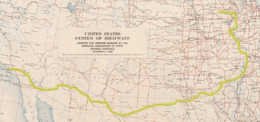
1926 US Highway Map showing the route.
Passed the Moorma’s Mineral Mixture Experimental Station. This was quite a sight. Had 12 different hog houses, each house had hog tight fence. Each lot had 8 or 10 hogs. You could see the difference too. Some were lots better than others. Had nice building every where on this farm. This is north of Quincy, Illinois.
Corn is badly blown down near Quincy. Had two bad bridge detours just before entering this city. One place was so narrow we almost ripped the left side curtain off. Went into Quincy at 3:00 Took 20 minutes to drive thro here. population in 39,131. Had to pay 40 cents toll to cross the bridge. The old Mississippi river is surely a wonderful sight. The children seen their first steamer, tow boat and barges today.
This puts us over on the Missouri side. Gas [is] 2 cents higher on this side of the river. Drove on over a very hilly stretch of road. Came up a very steep hill across the railroad, a very dangerous one too. Are traveling on the ridge of the Ozarks.
Missouri is surely awful rough. Stones and bluffs. We pulled into camp at Palmyra, Missouri, at 6:00. Another party here from Louisiana. Got supper. Went to bed. Sun shone a little today.
Friday, October 22, 1926
Ready to travel 7:30. Drove through a very hilly stretch. Lots of corn in the shock through this district. The farms are close together, buildings very small. Pears through here 50 cents a bushel, every farm has a small pond, lots of timber also. Good paved roads from Palmyra to Hannibal, Missouri.
Hannibal is some city, it has one of the largest shoe manufacturing plants in the world. It is built right in the bluffs. The street we came down, every house has from ten to twenty steps before you could enter the door. Nice large houses, most of them are new. Lots of negroes here. Stopped here to find out about the roads, one dose of having to drive back is enough. Changed tires, had one rim cut. Population is 19,306, left Hannibal [at] 10:00.
Hills and then more hills, the road here winds around through the hills. Little land that would do for farming here, you can look out any direction and see timber for miles and miles, don’t know what they are making a living from. Mostly cows and chickens, I think are their main stave. Lot of people living along the roads here just the same.
Had our first blowout just outside New London, Missouri. Most everybody in Missouri raises geese and ducks, and lots of chickens too. Got our first glimpse of a real rock bluff. The roads through here are very good, mostly rock and gravel. Got dinner while the boys fixed the tire. Stopped [at] 10:20 put the tire on, discovered it had another leak, so had to take it off again.
Left at 1:00. Over one and a half miles of new road just opened. Of course our luck isn’t all good luck, so into a chuck hole we went, had to push out. Got it started and on again, soon drove onto pavement this makes us all feel better. Drove over pavement for about three miles, then on to a detour round and round the sharpest corners, twist and turns. This road took us out into the Ozarks again. Came around one corner and over a bridge so sharp it was almost an impossibility. The roads are well marked and it’s a blessed good thing too, because it would be almost impossible to avoid serious accidents if it was not for these warnings. These roads are full of sharp rocks, people here call them cobble stones. Had more tire trouble with the same tire, nothing more than we expected this time. Had to change tires again, had a dickens of a time this time. Boys are getting disgusted with our tires, so it won’t be long before we hit each bump twice (hard tires, see). [They’re] getting pretty sour over the matter, so I’m making a little chocolate fudge to sweeten them up a little, when the trouble is over.
Fixed at last, drove on, luck follows most fools and so it is with us. We came upon a construction gang putting in new pavement, and… O-boy of all the bumps and thumps we did get, things out of the cupboard and cabinet just flew, luck was with us nothing broke. But Oh! what a mess, had to stop and straighten things around. On again into Frankford, Missouri, stopped here for gas and oil.
Have a detour from here to Louisiana, Missouri, won’t make much mileage today, we are 120 miles yet from St. Louis. These detours sure do take in the miles over everything. This state is chuck full of rock. Never did see so many before in all our lives. Lots of people living through here, but guess they don’t know there are lots better places to live. All a fellow has to do is get away from home to realize how big this world is and how little of it we have seen.
Down again, went through a chuck hole before we got out of town, the spare tires drug till the strap broke, so had to stop again. Made another effort to remove ourselves from this God forsaken country, didn’t have any better luck this time. Had to push, but that didn’t do any good. They monkeyed with the engine, finally found we were having timer trouble. Cranked it, and the little old Ford rambles on once more.
When you’re not going up you’re going down in this state. Go two miles to get one. On we go, up hill and down round and round. We have all of Missouri we care for. Thump, thump down goes the tire again. This is the third time today, don’t think we’ll get much further today. Change to another tire, maybe this one will take us into camp.
On we go [and] have 5 miles to go before we reach a campground. It is growing dark, it soon overtakes one in these hills. Drove up one grade, a gradual climb for one mile before we entered Louisiana, Missouri. Got dark and we had quite a time finding a campground. Finally got settled for the night, 6:30.
We saw the old fashioned rail fences today, on our whole day’s drive, have seen very few desirable places to live. The only place we saw any corn was in the low lands or along the bottom of some creek or river. You can see along these where the water has been very high.
As for thrills, Missouri has some, as you can’t see very far ahead at a time and lots of time you come unto unexpected curves, lots of narrow bridges. There was hardly a cross road entering on the road we traveled. Don’t know how these people reach this one and only main road. They told us in Frankford, Missouri, we couldn’t miss the road and I guess we couldn’t as it was the only one.
This has been a bright sun shiny day, but cold in the wind.
Saturday, October 23, 1926
This morning finds us up and ready to start. This is a nice campground, on a corner block, 27 blocks from the heart of the city. The city lies on the Mississippi and has a population of 5,000, lots of Negroes here. The Starks Brothers Nursery, one of the largest in the U.S. is located 5 miles from this city. We were lucky enough to camp on the corner, where the men wait for the bus. This is a six wheel tractor bus owned and operated by the Stark brothers for the sole purpose of taking their help to and from work. There was 25 or 30 men in this bus. Don’t know how many more they pick up, but had room for many more.
Left the campground at 7:20 drove back into the city. This is an awful smoky city, can’t see more than 6 blocks ahead. Stopped at a filling station for gas and air, while here saw 3 more Stark Brothers buses, 2 of these buses were for women. None quite as large as the first one.
91 miles from St. Louis left at 7:50. Traveling on U.S. number 61, from here had to stop at a railroad crossing just out of time. The bluffs along here 150 ft. high, as near as we could judge. These are the highest we have seen. This road took us for a mile right along the Mississippi river. This was a wonderful sight. Had a nice level stretch for about 3 miles, then we came into a more rolling country, then into the hills, but nothing like yesterday.
More farming through here than we have seen since we got in Missouri. The corn is fair. Some oats in the shock yet, growing here just the same as in Illinois. Lots of pears and apples here. Drove along one creek this morning that was quite a sight for us. The bottom was layers of flat white rock. Water as clear as a crystal. Drove on into the bluffs, drove out again onto the level just before we struck the town Eolia. Think this mostly Negroes, the name surely is a Negro name at any rate.
Stopped and got some groceries. On again [at] 9:55, 35 miles more to pavement. Have had a real wind storm south of Eolia, the corn for a short stretch is completely flat. Up hill and down all the way from Eolia to Flinthill, lots of fields of soybean and alfalfa here. Had to stop along the road to fix the lugs on the hind wheels, we are having trouble keeping them from slipping. This goes to show we are traveling over rough roads. These roads are natural rock, crushed rock, and gravel.
Passed a log cabin on our way this morning. Lots of rail fences through here. We crossed Cuivre River, where the corn had been completely submerged. The corn in these fields are worthless. 11:36 had to stop along the road, coming up a long grade, for a flat tire. When we stopped discovered the other tire was about off. Got dinner while the boys fixed them up. Ate dinner, started again [at] 12:15. We are one mile from the town of Troy, Missouri. Stopped for gas in Troy.
On we go, up hill and down. Country about the same from Troy to Moscow. Detour from here to Old Monroe, every bridge we have crossed in Missouri has been very narrow just room enough for one rig. I think they have been saving on bridge material. The farther south and east we go the poorer gets the corn.
Whiz ——— out goes a tire. Stopped [at] 2:00, O Boy! This is great. You don’t know the half of touring till you have lots of this kind of luck. The kids are making good use of these Missouri stones, using someone’s chicken coop as a target. Tire changed and gone again [at] 2:20. Lots of fall seeding being done through this section.
We rounded a curve over a bridge and up a steep rocky grade. Got half way up and pushed into low, it refused to take hold. So here we are stalled again. Blocked our wheels, lightened our low band, gave her a push, hopped in and on we go.
The country south of old Monroe is more level, more farming done through here. Lots of Jersey cows through all sections which we have passed through. Came unto the pavement 41 miles from St. Louis at 2:10. Oh Joy! We’re all glad. This land right through here lays as nice as any Iowa land. Better farms and things look more prosperous.
Bang! Bang! Blow out! We’re having a lovely time, believe this or not. This gives me lots of time to jot down all I would like to write. This all happened 20 minutes after we hit the pavement, guess we all felt too hilarious over better roads. I have often wondered why some people speak of Missouri as misery, I know the reason now.
Things all patched up and ready to ramble again. 2:45 it is sprinkling again. Lots of cars on this road, and this is paved clear to Kansas City. Stopped at the first filling station, fixed up some tires started on, 3:15. This road runs right along the railroad track, up hill and down, just the same way only we’re on pavement and don’t notice it quite so much. This has been a nice drive to St. Charles, the farm land through here is about the same.
Drove into the campground at 5:30, set up tent, got supper.
Popped corn and spent the evening laughing over our days drive. Camped within one half mile of the Missouri River, could see both the railroad and drive bridge. These are large 5 span bridges. We sure do enjoy these sights.
Went to bed.
Steady rain most of the night.
Sunday, October 24, 1926
Started this morning at 9:00. Drove 7 or 8 blocks, crossed the river, 50 cents toll for our gang on this bridge. This is some muddy old river, about 1/4 mile wide, 18 miles from St. Louis, good pavement all the way. Still traveling over hills and around curves. Filling stations, bill boards and eating houses every few miles. If one goes hungry, runs out of gas, or loses his way, it surely is his own fault.
Hundreds and hundreds of cars on this drive pass us going both ways, 8 miles from the heart of St. Louis. Have no free campgrounds here, 50 cents a day, some places a dollar. Pulled into the Sundown camp and parked, will stay here while Clarence and Grover locate the folks. Had our dinner, kids are trying to enjoy themselves while waiting 1 [and] 1/2 hours.
Honk! Honk! Here comes Jack and Mr. Carnes, we got into their car, dirt and all and away we went into the city. And I’ll say, “St. Louis is a real city”. Traffic of every description, and this is Sunday. Don’t know what it is like on a week day.
We finally got down to the house and we are all glad. Spent the rest of the day visiting.
Monday, October 25, 1926
Didn’t get up so early, we all enjoyed our night’s rest. Went out to camp, gathered up our dirty clothes and brought them back and washed.
Clarence, Jack and Grover have been out seeing the city and looking for some tires to suit their needs. We girls are going sight seeing tomorrow.
Tuesday, October 26, 1926
This is another day in the city, and nothing much to do today but visit. The boys did not find what they wanted, so we girls will have to wait for our trip till tomorrow.
Essie and I went down to their part of the city, this is one of the suburbs. There is all kind of stores, any direction you may care to go.
Did not go to bed till midnight.
Wednesday, October 27, 1926
This morning Jack took Clarence and I out to see the city, and we saw a most wonderful sight. First we took the street car down to the heart of the city. I wouldn’t dare say how many cars and busses this city operates, but it surely is an enormous number. The street car company alone employs 5,000 motor men and conductors.
We got off the street car and went into Woolworths Ten Cent Store. Such a variety I never did see. One wonders where so many things come from and how they can get so many different things in one store. This store has four floors, each floor loaded with 10 cent articles. You only have to stay a few minutes to get an idea of how these kind of stores are patronized. We left this store and went on to one of the larger department stores. Here we got our first ride on a moving stairway. This surely was a new idea.
There was two stairways, one going up and one going down. If you wanted to go up, all you had to do was step on and stand perfectly still and up you would go. All one did was be in readiness to take a step or two right at the top of the landing so you wouldn’t loose your balance. These have steps just like ordinary stairways, only not such a straight steep step. This gives the party ahead a chance to step up to let the person behind have a chance to step on.
This is an ideal rest for weary shoppers. We went up three floors then we took an elevator. Have been in these before so this was no thrill.
We went from here to the Railway Exchange Building, this is next to the tallest building in St. Louis. The Bell Telephone [building] is considered the tallest. We took the elevator and up we went 21 stories. That took us up to the top story, but still this didn’t quite satisfy us, so we paid 25 cents a piece for a ticket to go to the roof. This entrance took us out onto the next roof, then we climbed two flights of stairs. Oh my! How the wind did blow, had to hold our hats to keep them from blowing away. This put us up above the city. We could see for miles and miles in all directions. This was well worth the price and a sight we’ll never forget. We could see the old Mississippi winding its way through two cities, [East] St. Louis, Illinois, on the other side of the river is a large city all its own. When we looked out over the city, people and automobiles look like miniature toys. We could see cars passing over the bridges between the two cities, and it surely made one think of a busy ant hill. If one has ever stopped to watch these busy little fellows, you have an idea of how things looked to us from this point. We came back to the elevator, and down we came.
The elevators are mostly run by Negro girls. I’m afraid this kind of job would make me seasick, but suppose a person would get used to it.
We spent all forenoon bumming around looking at the sights. Got back in time for dinner.
Photo in St. Louis’s Forest Park. Left to Right: Beulah, cousins Francis (age 1) and Hazel (age 6), Delmar, and Velma.
After dinner Mr. Carnes took the children and us out to Forest Park, this is one of the largest parks in the state. They have a large zoo here too, the kiddies all enjoyed seeing the animals, especially the bears. Had four different kinds. Nature itself could have produced no better homes for these animals. These pits were built in the side of a hill, just like a place in the wilderness where bears would habitat. Large openings in the rock lead back into their dens. Each den had a stream of running water, they seemed perfectly contented. We saw most every kind of bird there was, had a house built purposely for these. This is a beautiful park with some of the loveliest drives we ever had an opportunity to drive over. This park consists of 1,500 acres. This was the park in which the Worlds Exposition was held in 1904. We spent most of the afternoon here and we have enjoyed this day.
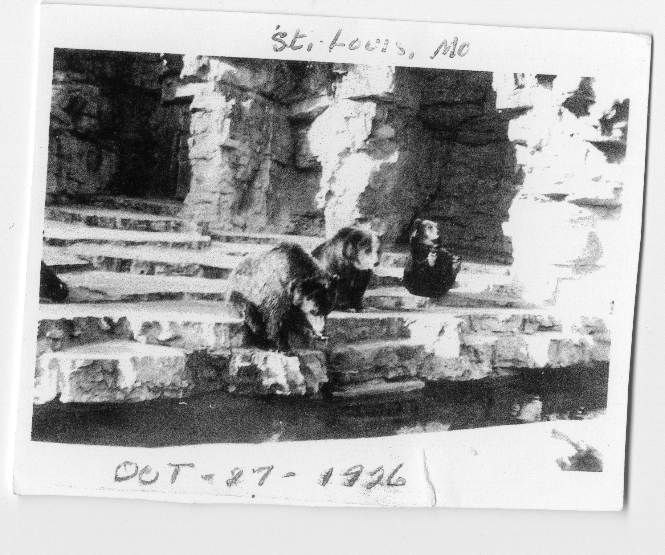
At the St. Louis Zoo. Notice the bear that has a hold of his toes. We had been throwing bread to them. They would sit up and beg. When we didn’t pay much attention to them, they would perform and try to attract our attention. That was the way I caught this one.
Went visiting in the evening, over to Kesters, these are the people who were with Jack and Essie when they visited with us this summer. Went to bed late.
Thursday, October 28, 1926
This day finds us ready for another sight seeing day in the city. Mr. Carnes took the children, Essie and I in his Nash car, the boys took the Ford and away we went to the Chain of Rocks. This is on the Mississippi River, out from the city about 12 miles. It is where the water is purified for use in the city. We drove up on the main heights to take a look over all. This was a very pleasing sight. We could see where the Missouri and the Mississippi came together.
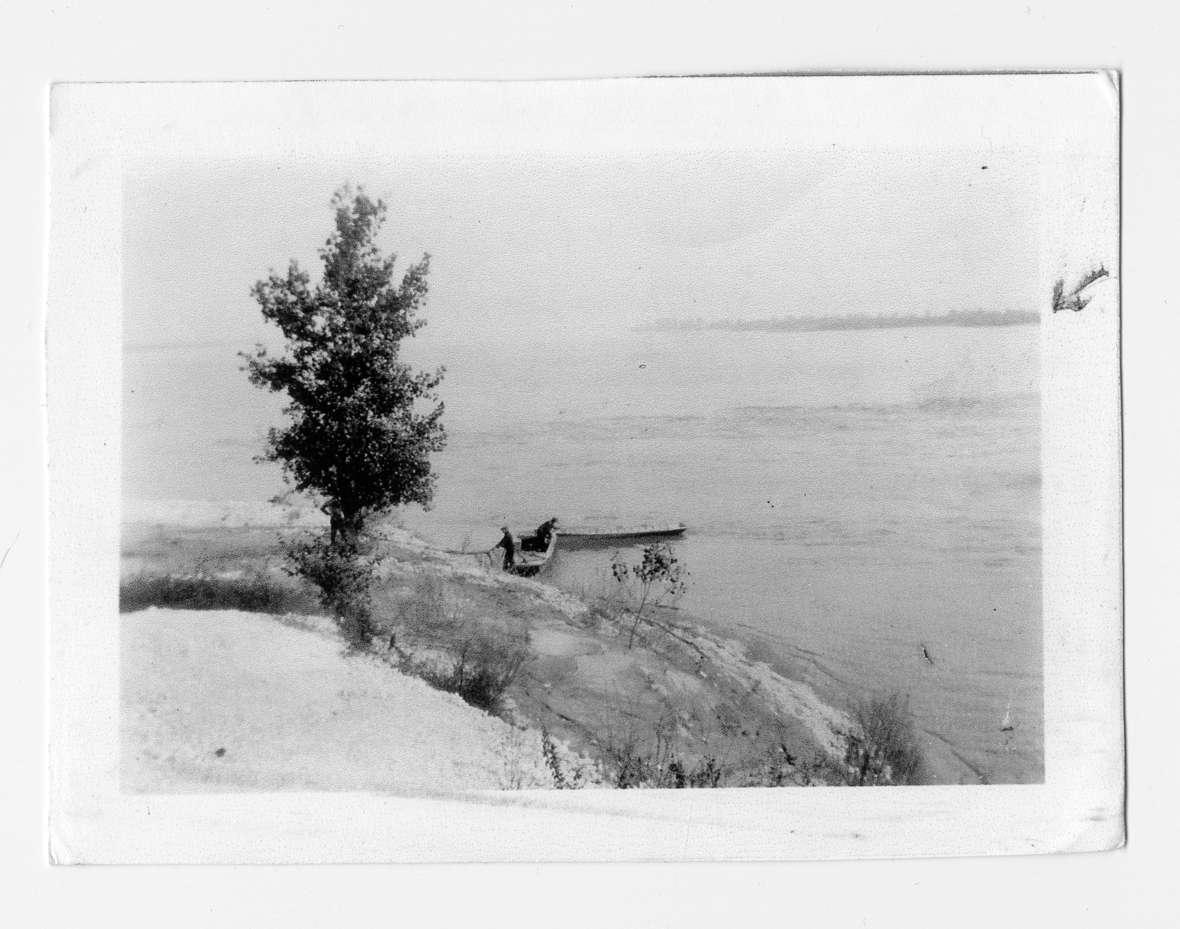
‘This was taken along the Mississippi River. These men just came across in a motor boat and I took this just as they were landing. This was a wonderful sight. We could see from the place where we were standing where the Missouri River entered into the Mississippi. The dark place on the other side where I marked the arrow was an island.’
The water is pumped from the river into large vats or tanks. Lime and iron and other purifying chemicals are added to these. We could see where a large stream of lime and another stream of iron were running into the vats to be carried on into the water.
We went into the pumping station, and of all the wonderful pieces of machinery we beheld. To give you some idea of the size and capacity of these pumps, will give a few figures we got at the station. Each pump will deliver 30 million gallons of water in 24 hours. Each pump is 375 horse power. These were installed in 1895 by the Allis Chalmers Co. They are of the crank and fly wheel type. We stood and watched these pumps while in action. Down below us 45 or 50 feet was a large room containing machinery to operate these pumps. There are eight in all, but not all are used at one time. They can use one or any number that is needed at any time. There are three of these pumping stations.
This is the number of gallons of water pumped at each station a week:
- Chain of Rocks - 840,790,000.
- Bissella Point - 496,118,020.
- Baden - 314,751,600.
This gives one some idea of the amount of water it takes for use in this city. This water is run through these purifying tanks, then run into a large outside tank, there are 8 of these 28,835 rods 4 in length and width, and 8 feet deep. Each one contains different chemicals and is let from one tank to the other during the process. One can easily see the difference in each tank of water. It is finally pumped into a clearing station before it is forced into the city for use.
No one can realize the vast importance of these purifying plants, until they see this awful muddy water that comes from the Mississippi. We were very fortunate to be there at a time when they were cleaning one of these receiving tanks. It is amazing, the mud and sediment that collects in these tanks. The mud was from four to five feet deep in places. A part of this tank had been cleaned. They had tractors and team busy at work removing this mud. These are cleaned every 6 months.
The men that invented these chemicals for purifying were brothers. They have worked so long and unceasingly at this one thing, that both have lost their mind. It surely seems a pity that when one works so faithfully for the welfare of others and accomplishes such a wonderful feat as this one is, not to be able to enjoy the reward for such a service.
We have had a wonderful time and have learned a lot. We left here and drove out to camp for dinner. Had a good picnic dinner. Cleaned up things and came back to Jack’s. On our way home we got a chance to see the city after it was all lit up. This is one thing St. Louis has failed on, it has a poor lighting system. Have some electric lights and some gas lights. A man lights these gas lights about 4:30 in the afternoon, and turns them out again in the morning. New electric lights are being installed, so they expect to have better service soon.
Traffic is terrible in this city after 5:00. This is the time of day when people are ready to go home from work. Was glad to get home safely.
This has been an unlucky day for people in this flat. One of the motormen that stays here, ran over [a] Negro woman tonight about 6:00. Did not kill her instantly but they say she cannot live.
Clarence and Jack went down town and while there Jack was trying to help some of the boys from his street car run remove a wrecked auto from the street. It had been hit by a street car. In some way Jack got his right leg pinned in between the car and a water plug. He came very near having it broken. Has got a very bad bruise.
Friday, October 29, 1926
This has been a really gloomy day in the city, very hazy [and] looks like rain. Clarence and Jack went down to the auto club to get a routing out of St. Louis.
Have tires changed and we are ready to ramble. They went out to camp and brought back our Ford, we start traveling again tomorrow.
We have had a wonderful time while here. Boys went down to the bowling alley after supper, we girls went to bed.
Rained most of the night.
Saturday, October 30, 1926
Bid Essie and the kiddies goodbye. We are leaving in the rain, Jack went with us as far as the outskirts of the city. Left here [at] 7:00.
We traveled all forenoon through just such country as we had north of St. Louis. Rained till 10:00. Have had quite a lot of brake trouble this morning. The brake bands we put in proved to be a little too heavy. Ate dinner at 12:20, at a filling station 5 miles from Bonne Terre, Missouri.
Have traveled on the ridge of the Ozarks, over good pavement all morning. This country is full of timber. We have surely seen Mother Nature dressed in her best. The trees in all the colors are beautiful, beyond description.
Most oak, walnut, ash, hickory and some pine found in these timbers. Lots of it has been cut over. The road winds round and round, timber on both sides. No farming land through here at all. Wish you all were here to make the drive with us, as it surely is grand.
We passed a very interesting place near Bonne Terre, Missouri. We first noticed enormous piles of sand, we wondered what they were doing with such a quantity of sand. Curiosity got the best of us so we stopped and asked a man who was passing us. He told us it was waste from the lead mines. This one mound covered three or four acres, it was about a 150 feet high. A track was built up to the top of this and a long tunnel like house over the track. Through this the sand is hauled and dumped on top of the mound. We could see several other mines from our Ford, but they were further away than the first one. This sand is a lead color, not like ordinary sand.
We passed on into another little town, this is through the lead and iron mines. We could easily see the difference, the iron mines have red waste soil, while the lead is a gray waste. The country through here is vastly populated, all houses built in this town are very small. We could see the shafts leading into the mines here.
Left this town on dirt roads. This road was full of chuck holes and we had to drive slow up hill and down, it jolted the bottom of our cupboard loose and we nearly lost our fruit.
People do more farming through this section. Have 26 miles of this dirt road to travel. Didn’t make a town by dark so pulled into a school yard to camp. The water is running across a low place in the road near our camp. Bluffs and timber all around us.
We had a look into an Ozark Mountain school. I tell you it is not much like our Iowa rural schools either. Have long bench like seats and desk, no shades or curtains at the windows. In the center of the room is an oblong wood heater. Back in the corner of the room was piled a number of sticks of stove wood. This is the only room they have, no cloak room of any kind. The children thought they would not care to attend school here.
We got our supper and went to bed early.
Has been cold and gloomy all day. Looks like it might rain some more.
Sunday, October 31, 1926
Got up early. Did not rain, so we are all glad, ready to start at 7:00. Drove for about 8 miles and off goes a tire. These roads are awful, worst we have struck. Fixed it as best we could, drove on till we came to another oil station, one mile this side of Fredericktown.
Pulled up here and debated about what to do. Boys went up town to see if they could find something to help us out of our difficulty, came back nothing doing. Grover took the bus and went back to Flat River, Missouri, this is back 30 miles, to see if he could pick up something. He got back at 11:00 that night, no tires.
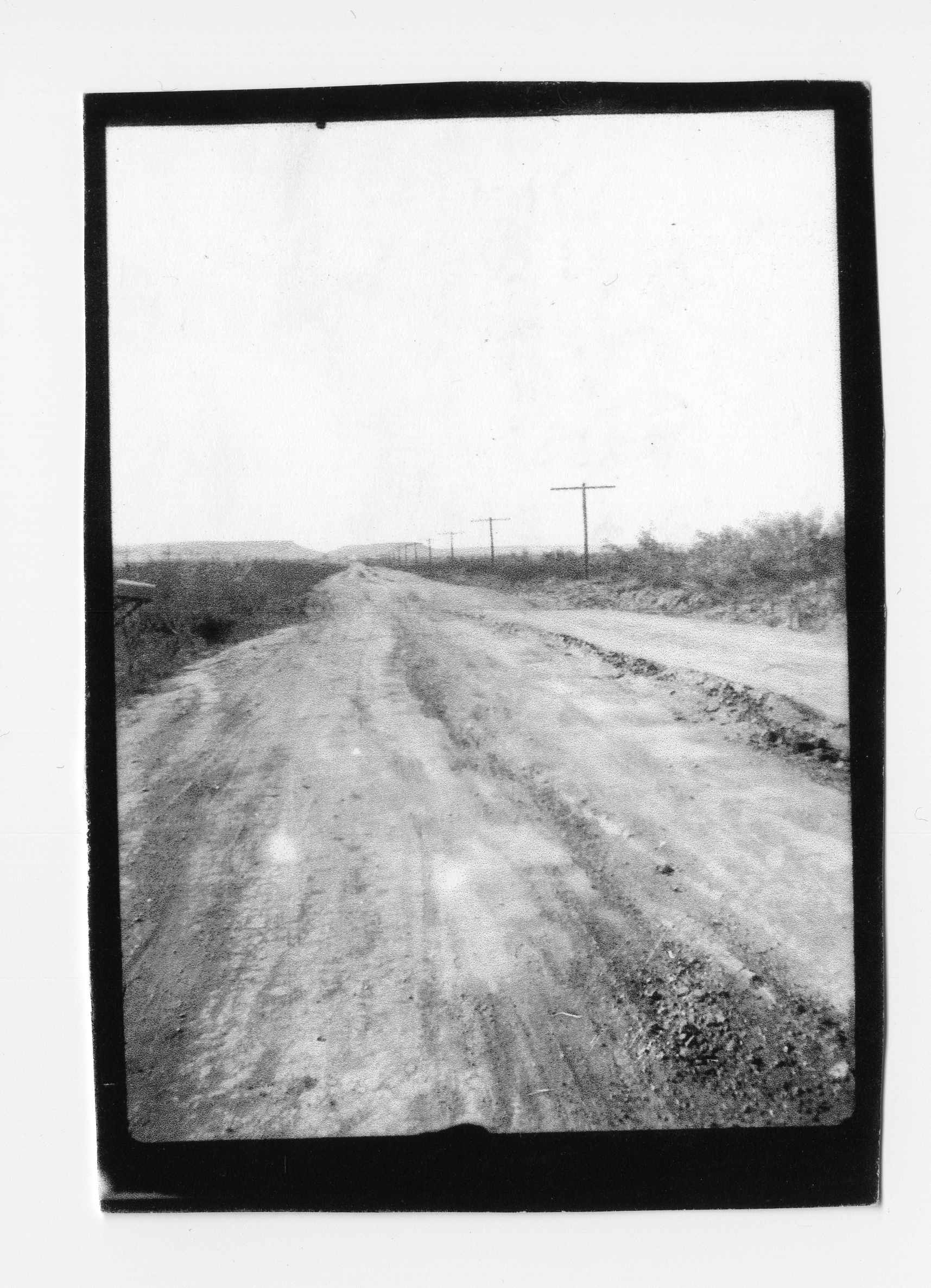
This photo was noted as taken on November 15, presumably near Odessa, TX. Perhaps this is indicative of the route’s condition in many areas?
Went to bed has been a nice day.
Sun has shone bright all day.
Monday, November 1, 1926
Did not get up very early. Got breakfast. We did up our work, changed things around in our house.
Boys went back up town, came back with new wheels, tires and tubes. These are real truck tires, 34 X 5. So we are in hopes our tire trouble ends here, changed wheels, this took some time.
Left here 3:46. Have 40 miles af pavement ahead of us, no town now for 24 miles. There are 7 filling stations in this 24 mile stretch. The country is about the same. We drive through a stretch of timber then out onto a little level stretch. Here will be a small farm, then back into the timber we go again. It is this way all along.
This is the only road we can see, it is wide and well paved. Lots of grades, we pulled one grade this afternoon in low for one mile and a half, not steep but winding up. This has been our hardest pull so far. Many places we can look ahead and see 2 or 3 ‘S’ shaped curves ahead. Most of the road is built to avoid the worst hills, so it runs in all directions. We drove on till dark forced us to seek a camping place.
Pulled into a filling station to camp again, near Millerville, Missouri. Not many tourist camps in Missouri. Got our supper and went to bed.
Sun shone all day, but the wind has been disagreeable.
Tuesday, November 2, 1926
Up at 5:00, got breakfast. Just as I was ready to call the rest, rap a tap, tap at our door. I opened it and there stood 2 boys about 18 years old. They had slept in a car all night and were about frozen. Qne had a light cap and a sweater, the other had no coat of any kind, his cap was just an auto visor. They were hiking to St. Louis. I let them in, when they got warm they went their way.
It froze water here last night. This is something very unusual for this time of year the station keeper told us.
Ready to leave here at 7:00. Stopped in Jackson [at] 7:40 for groceries, Fixed the brake rods again. On gravel roads again. Drove on to Cape Girardeau. Country through here about the same, have 10 miles of pavement from here. More farming done through this section, quite a lot af corn, but not extra good.
Passed the Marquetta Cement Plant, and this is in a lime rock bluff. We could see the chunks they had blasted out ready to grind up. Lots of rocky bluffs as we drive along. Left the town of Fornbelt, Missouri. On dirt and gravel roads again. Had to stop and put some little do-dad on our engine to make it work better. On we go again. Still going up and coasting down. Engine stopped on us again, had quite a time to locate the trouble. Found a wire broke in the switch. Ate our dinner, started again [at] 1:00.
Drove on into a very level stretch. This land lays about like our finest land in Iowa. Saw our first cotton fields this afternoon. Stopped and picked enough to send some back to the kids.
This is planted in rows 2 feet apart and about 12 inches apart in the row, grows about 3 feet in height.
Everyone from the Mammy to the little children picks cotton. They have a long sack tied around their shoulders. This they drag along behind them. They pick it off and poke it in the sack. In each field is 1 or 2 wagons with a square rack on it. Each wagon has a pair of scales on it. In this they dump the cotton, it is hauled to the cotton gin this way.
Passed a lot of wagons as we go along, they load on all they can, pile up bang boards as high as it is safe to do so. Some haul awful big loads. There is hundreds of acres of cotton through here.
Lots of young peach orchards all through the southern part of Missouri. We have come out on a level stretch again. Our road now lays as level ahead of us as it has been rough behind us.
All houses through this section are tumble down affairs. Every house is built up on cement blocks, no other foundations of any kind, you can see clear under every one. Most of these are Negro homes. They don’t know what paint is here in Missouri.
It would make you laugh to see them pick corn here, they only use a double box with 2 bang boards on the side, they straddle one row, then they pick up the down row. Most always see 2 at a wagon. Everyone we see working, works at it as though they hated the sight of corn. I would rather pick their corn then their cotton, this looks as though it would be an everlasting back breaking affair.
It is considered a good days work to pick 250 or 300 pounds of cotton. A good clean cotton picker can get 23-1/2 cents a pound, but he has got to be better than the average picker. 1,500 to 2,000 pounds to the acre is considered a good crop. They raise cotton here like we do corn in Iowa.
Pulled into camp on a vacant lot at New Madrid, Missouri. Have to work on our engine tomorrow. Three other parties here tonight.
Wednesday, November 3, 1926
Didn’t get up very early this morning, got breakfast. The boys started work on the car. When along came two women tourists from Chicago, en route to Plant City, Florida. They were having trouble with their Ford. Stopped to find out where the garage was. Grover looked the things over, found out it was dangerous to drive it. The whole dashboard was broken so badly, they could hardly steer it. He went up town and got a new board and fixed it for them. We girls had company for 4 or 5 hours.
I washed our dirty clothes today. Lots of tourists going both ways. We are on the main highway so [we] see them all.
Have had a disagreeable south wind all day.
Thursday, November 4, 1926
Got up at 7:00. We did up our work, wrote some letters, helped the kiddies make some doll clothes. The boys got the engine together, but couldn’t get it started. Will try again tomorrow. Have new neighbors for tonight, an old, old man and woman driving an old horse with a dilapidated wagon, They look as through they were nearly froze, I think they are pretty old for such jaunts. She begged coffee enough for their supper. They wanted some meat but did let them have this. She looks as though she might be part gypsy. Hope the sun shines tomorrow for their sake if not for ours.
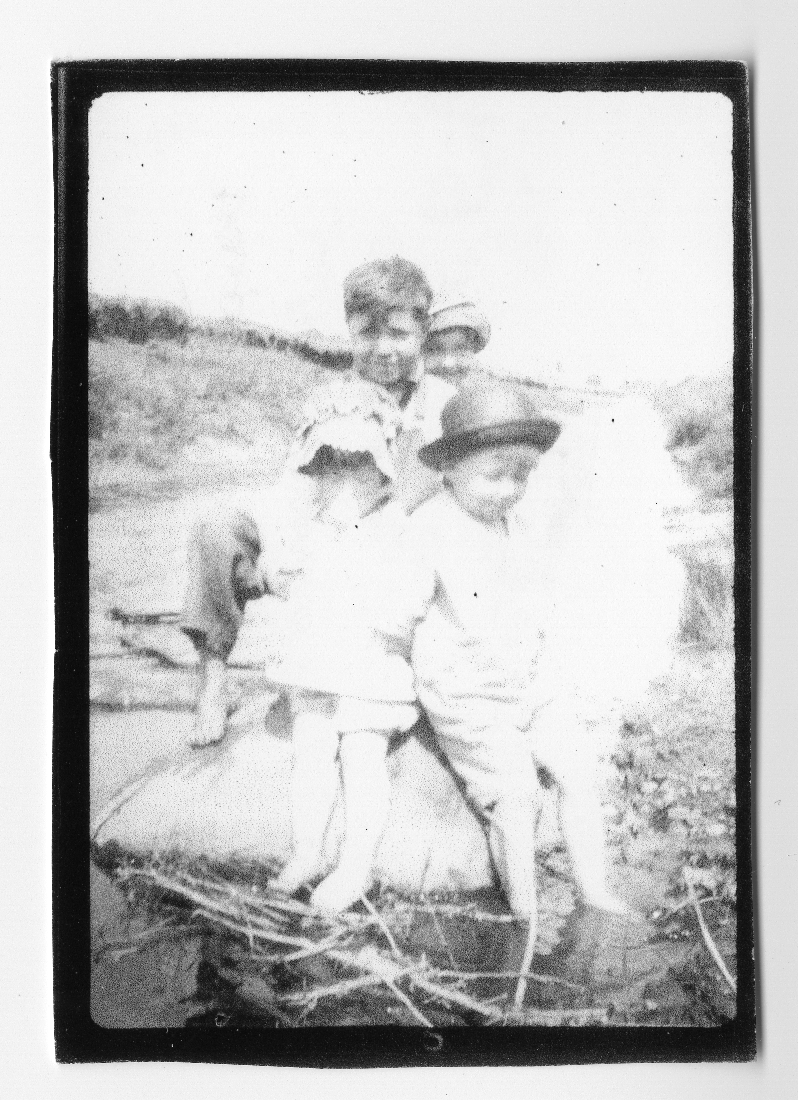
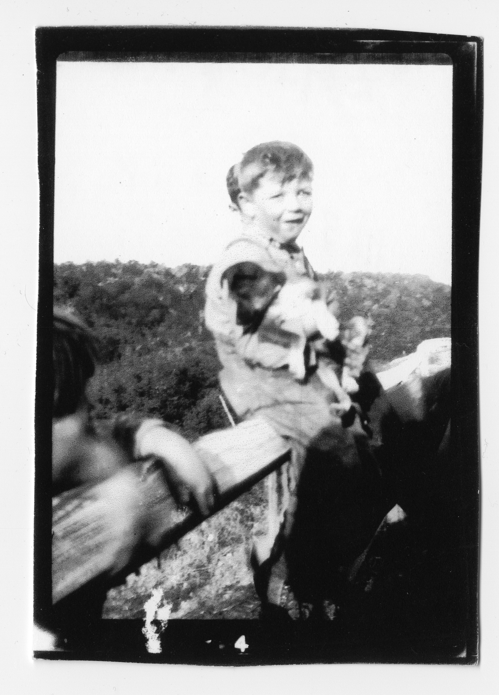
This photo, presumably taken November 15 near Odessa, TX, appears to include Beulah and Delmar seated in the foreground, with Kenneth and Velma standing behind.
Friday, November 5, 1926
Had to pay a $1.00 to have this old Ford pulled to get it started. Picked up and ready to leave here. The old lady begged some more coffee this morning. They just about froze last night. Had a heavy frost here, but the sun shines bright, so it will be warm after while. Gave them what wood we had left and a dollar bill. Maybe one good turn will bring us one. Poor old folks like this are to be pitied.
Left at 9:20, drove on through a very level stretch of country, about the same amount of corn and cotton raised here. Large patches of sunflowers too. No wonder they have nicknamed Missouri the “Hound Dog State”, it surely is one. Everyone has 2 or 3. We don’t see many horses, but lots of mules. All buildings and fences are ramshackle, don’t see how people live in them. Wherever they use any paint it is of the most brilliant hues.
Have passed load after load of cotton going to the gins. Every way you look you can see Negroes at work picking, they have to pick this every 2 weeks. The bolls do not all burst open at one time, you can easily tell where it was picked a week ago. The white blossoms are scattered here and there, then where they are picking it looks like rows of little brown bare trees, and where they haven’t picked it is just a confusion of white blossoms. Wish you could see these cotton fields, as it is surely is a sight.
We passed a great large transportation truck in the ditch this morning. I think the driver must have fallen asleep, as it was not a bad place and he was off on the wrong side of the road. It looked as if he had driven right into it. At any rate it will be a big job to get it back on the road.
This abridged Rootstalk edition of the family’s travel is abbreviated here as the family passes from Missouri into Arkansas. Their travel through Arkansas, Texas, New Mexico and Arizona has been omitted from this version of the text to better manage the length of the article. The daily transcript resumes on November 24 as the travelers pass from Arizona into California and the last days of their journey west.
The full text of the original transcript, along with additional insights, statistics, and updates, can be found at https://1926.mcfate.family, and a searchable McFate family tree is also available as part of https://tree.mcfate.family.
November 5-23, 1926 - Arkansas, Texas, New Mexico and Arizona
Arkansas
A summary of travel through Arkansas included mention of cotton, cotton gins, and saw mills. Some of the farm land looked poor and neglected. They passed through an area with wheat, the first they’d seen since Illinois, and an area of irrigated rice.
Passing through Little Rock, AR, they were impressed by the capitol, the railroad bridge and separate bridges for street cars and for automobiles… “the best river bridges we have crossed. Lots of nice homes with names.” Hot Springs was described as a lovely city with four magnificent hotels, bath houses, drinking fountains along one street providing steaming water; many crippled people here.
They encountered an area of high bluffs and large fir trees – “our first real mountain roads”, and “drove 15 miles without passing a gas station, the greatest distance since leaving home.” They mention Cotton and corn growing here, but the fields are very rocky.
Texas
On November 9 they crossed into Texas at Texarkana, “a nice clean city.” Country more level than Arkansas, lots of cotton.
Paris, Texas, population 16,000 mentioned as “sure a fine city – cotton everywhere here.” More cotton around Greenville; people here travel in covered wagons, have seen a great number; the men all have long moustaches and wear “real Texas hats we often see in pictures.”
- November 11
On November 11 they passed through Dallas – “a big old city” population 177,000. Gas for cars is sold everywhere, price 13 to 21 cents, lots of competition. Got to Fort Worth, a big city, but Miriam didn’t include population numbers.
There are many references to prairie, but much of it was probably short-grass prairie, not like the tallgrass prairie in Iowa, and some of what they called prairie seems thistly and scrubby. There are also plenty of limestone outcroppings, moving her to write “Texas isn’t all prairie” and “much of the land west of Ft. Worth is good for nothing but pasture.”
Delmar sitting on a fence rail holding Dallas, the pup that Kenneth found in a gunny sack.
On November 12 near Ranger, Texas they spotted oil wells and a refinery. They mentioned “timber country here”; got to Cisco, TX, “about as large as Grinnell.” Abilene, was their last real city until they got to El Paso and they were “back in cotton country.” Around Colorado City, TX, there were massive painted signs on boulders with religious messages. Then, more cotton country; not much to see west of Westbrook TX, with few cars coming or going. Near Stanton, TX… Wide open barren country, nothing much but sage brush, shrubs and grass, “just one vast prairie.”
In one 3 mile stretch they passed one filling station and one ranch house. “The only living thing we saw was a small white goat that maybe strayed from the flock. Didn’t even see any birds.”
Came to place where grass was very short and few shrubs, got first glimpse of prairie dogs. 5
- November 16
Got to the Rio Grande, another cotton area, including the Algodon Plantation of 5000 acres. Lots of Mexicans lived here, she observed, in little flat-roofed houses made from mud bricks (adobe). Along the Rio Grande approach El Paso seemed really nice – “If one had seen only this part of Texas, they would think Texas was a garden of Eden” – lots of big cottonwoods provide shade, and nice houses. El Paso – a town of 90,000 [2020 census was 678,000].
Reached Mesquite, TX, the boundary between TX and NM… “We bid old Texas good-bye. Don’t know whether she was as glad to see us go as we were to leave or not. We sure were glad to get to another state even if it was full of Mexicans” who were picking cotton.
New Mexico
Well into New Mexico they “finally come to a stretch that we can call desert.” Mostly sand, very short grass growing in spots, no trees or bushes. A little farther on came to an area with a lot of century plants and sagebrush. They’re building a new road through here, but it isn’t open yet and there are lots of detours.
“The sun shines so hot. The road is awful dusty. It is very hard for us to believe Thanksgiving and Christmas are so near. When we pass through the towns and see all the Christmas displays it seems funny to us.”
Gila River – some ag here: cotton, corn and alfalfa. Several settlements of Indians – very poor, dirty, ragged.
Arizona
Long distances were mentioned in Arizona, terrible dust in the desert; cactuses of different varieties. Lots of Mexicans and lots of mountains were mentioned in Arizona.
- November 21
Near Mesa, AZ, saw first oranges growing. Lots of people raising bees. Water from the Roosevelt Dam. The country between Mesa and Tempe is very nice, then Tempe to near Phoenix is desert again, then near Phoenix the country looks better again.
“Great herds of stock cattle and milk cows too. We have seen many herds of sheep this morning, thousands in a flock. Each flock has a herdsman, they live in a little tent right out in the field. They stay with the sheep night and day.”
“We crossed the Aqua Fria River, this river was perfectly dry. Like all the rest it is a shallow one and very wide.” The bridge across it is 1/2-mile long.
The unabridged content of the journal resumes here as the family passes from Arizona into California for the remaining four days of their journey.
The full text of the original transcript, along with additional insights, statistics, and updates, can be found at https://1926.mcfate.family, and a searchable McFate family tree is also available as part of https://tree.mcfate.family.
Wednesday, November 24, 1926
Nice and warm again this morning. Do not need any fires here. The sun is just coming over the mountains [at] 7:55. We have carbon to clean out of the Ford this morning, so will not get a good start for this day.
The mountains through here are a part of the Sierra Nevada. Did not start till 8:30. Drove out of this little railroad town into the desert. The grades on the railway are so steep they have an engine that stays at this little burg. They use it for an extra, it pulls up one grade and pushes the next freight back. This is what helps to make our mountain freight rate so high.
Drove on over more desert till we reach Dome, Arizona, 39 miles. Here we had to pass through some hills. We won’t call them mountains now since we passed through the real ones Sunday. Have found out since [that] the elevation of the mountains are 4,800 feet. This is the highest point we had to pass.
From Dome to Yuma it is 26 miles. This is all desert except 3 or 4 miles through these hills. The Yuma desert is more like we think it should be. Nothing, only a very little desert grass and sand.
Stopped along here to help a man get his car started, then we drove on to Yuma. This is quite a large city for a desert city.
We crossed the Colorado River here. This is not a very large river, little larger than the Iowa. It is not as deep but is wider. The water is very red too.
Crossed the bridge at 2:30. Here we were held for inspection again. This time it was for plant inspection. Everyone has to be inspected before crossing the line. They do this to keep out plant disease and all destructive germ and bugs to plant life. We had to open all our suitcases, bags, boxes, and cupboard. They inspect everything. We had nothing, so they turned us loose. We were glad too because we have had no dinner.
We stopped a short distance from the inspection station and ate our dinner. This was our first dinner in California. We drove 6 miles thro the Colorado River valley. This is mostly farmed by Mexicans and Indians. They raise quite a lot of cotton.
We drove into the foot hills and desert again. Next town is 15 miles. Roads are very sandy. Lots of loose gravel. We finally came to a place where they were oiling the roads (what a blessing). This is all desert, just about the same as we have come through.
Drove on and on. We have come to a stretch of country where they have the sand storms we have heard so much about. The sand is piled in drifts. Some places 50 or 100 feet in height. I doubt whether a person could drive when the sand was blowing hard. It looks to me like it would be like driving in a blizzard. The wind is blowing a little this afternoon. It blows little drifts across the road, with just a little wind. This sandy area covers 10 or 15 miles.
The old road is lying right along this one. It is called a corduroy road. It is made of ties or slabs wound or tied together to form a road. Just room for one car. Every so often there would be a lap in this road, making it wide enough for two cars. On these laps were where one car had to wait for the others to pass. These laps were about 40 or 50 rods 4 apart.
Some of this road now is completely covered with sand. We are satisfied now that California is the only state through which we have come that has a desert like we expected to find.
We drove on till dark, pulled into a filling station camp, 9 miles east of Holtville, California. This is the gateway to the Imperial Valley. We can hear the water fall over the dam in the irrigation ditch from our camp. A Negro man and wife keep this station. They are real sociable people.
Thursday, November 25, 1926 - Thanksgiving Day
This surely does not seem like Thanksgiving to us. We could sooner believe it is the Fourth of July, it is so warm.
We started at 7:30. This valley is all farmed, they have 2,000 acres of head lettuce through the valley. Doesn’t this sound fishy? Nevertheless it is true. Japanese at work everywhere. Some hoeing, some plowing and in other parts they were picking and packing. This all belongs to a company. They work this a good bit like the sweet corn at home. It sure is some sight. On the other side of our road are acres of grapes.
We stopped in Holtville for gas, 20 cents. Drove on through this valley all forenoon. Saw lots of stock, chickens, lettuce and fruit. Stopped about 7 miles east of Kane Spring, California, to fix a rod again. Got dinner while the boys were fixing it.
Sun sure shines hot out here on the desert. A shade is a blessing here. We had been told that California sun shine was a scorcher but never would believe it till today.
Drove on at 1:20. Drove on to some public scales to weigh our rig. The boys have been crazy to know just how much this has weighed. So thot we would find out free of charge. Clarence had just got it weighed when some fellow stepped around and charge him 25 cents. They thought it 25 cents worth of satisfaction anyway. Weighed 4900 lbs. without Clarence and Kenneth.
After leaving here we came into a strip of desert again. We drove for 45 miles over real desert. Off to our north lay the Salton Sea. We drove all afternoon in sight of this. Came within a short distance of the shore, this was at the west end of it. It has no inlet nor does it have an outlet. Its water supply comes from springs. It is a great game resort. Sign up along the way about duck hunting. Charge $3.00 a day for shooting ducks. They are so thick they claim you can’t help but hit some. We were just 5 miles from where they were so thick, but was afraid if Grover went we’d be minus another gun. 6
After we left the sea, we came in to another valley. Here we passed great orange groves with yellow ones and green ones on the same trees. Grapes, dates, asparagus and onions all growing here. Acres and acres of them. This is at the foot of the mountains.
We can drive along and see spots of desert, drive a little ways further and see fields of splendid crops. This is where it has been claimed and where it has not. You’ll never believe this till you see it with your own eyes. It sounds just like a fairy tale. It is amazing what a little water will do. To see the soil you would say it was impossible, it is such very fine sand.
This now is called the Coachella Valley. Lots of dairies here. This is a great date country. Fresh dates, 15 cents a pound.
The sun has dropped behind the mountains, so we will have to find a roost. Drove on to the little town of Coachella and found a campground, 6:00. This is not a very large place. Mostly Japanese and Mexicans. 6 other parties on the ground tonight.
Happy Thanksgiving!
Friday, November 26, 1926
It is cooler here this morning. It sure makes a difference down in a valley here in this country. Ready to go [at] 7:05.
This valley is watered from water that comes down from the San Joaquin Mountains. As we pass out of the city we could see the clouds sailing across the mountain tops. Some times we could see the peaks very clear, then a cloud came floating along and the mountain tops were invisible. We enjoyed watching them come and go. These mountains are all rock. 3 miles from Coachella to Indio is very nice country. Dates, grapefruit and onions are the main crops.
After we left Indo we came into more desert and sand hills again. This land through here sells for $30.00 an acre. From here we have a raise of 1,800 feet but it is so gradual one can hardly notice it. If it wasn’t that we could look back and see the grade, one would hardly believe it. Nothing interesting along this strip.
We are 42 miles from Banning Mountains. Mountains all around us now. To look ahead it seems like it would be impossible to ever get across them. Most all the peaks here are hidden by clouds.
There is one fertile spot through here where they have English walnut groves. Here they have artesian wells for water supply.
We have drove for miles and still our mountains are in the distance. It looks as if you could drive into them in just a few minutes. We can drive and drive and still they look the same. This grade does not have such sharp curves, it winds up but more gradual and longer space between each curve.
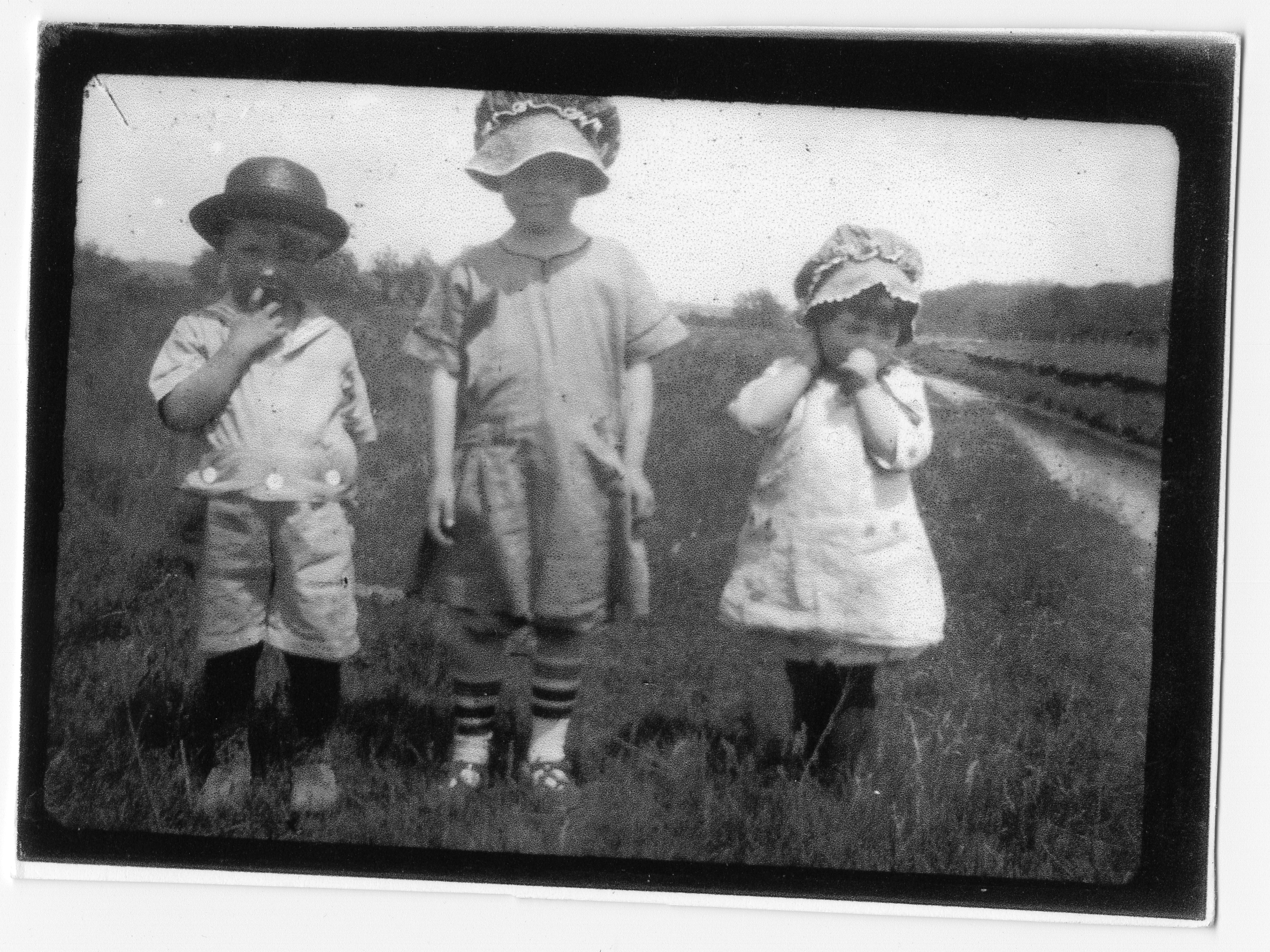
Left to right: Delmar, Velma and Beulah. Date and location are unknown, but the terrain and vegetation reminded me of portions of Iowa, Illinois or Missouri.
15 miles to Banning. We drove through Vista Canyon. The wind is blowing a gale through here. It isn’t a warm wind either. Right at the lowest spot in this canyon is a little fertile place. A big sign board here telling about the all-year summer resort. Just a little village all by itself. The Southern Pacific Railway runs through here.
The rocks in the highest peaks glisten like they had snow on them. We never did get to see the highest peak here as it was completely covered with clouds. This is called the Crystal Mountains. One of the most beautiful things we ever saw or expect to see, was a rainbow flashing up the mountain side. Sometimes we cannot see all the tops on account of passing clouds. Never have seen the color so brilliant. This seems to come right up out of the desert on this side of the mountains. This truly is a wonderful sight.
We stopped at a service station a short distance on. One can tell by the trees here, that they have some terrific wind, it always blows from the same direction. The tree branches, leaves and trunk are all inclined to lean one way.
Many nuts grown here, almonds, pecans and walnuts. We met our first California shower as we came into Banning. Fruit orchards now line both sides of our road. Rows and rows just as far as one can see, prunes, dates, lemons, oranges and apricots.
Drove on to Beaumont. Country practically the same. Stopped here for some groceries. Stopped for dinner 12:50.
Drove on to the mountains. This is where we have to finish the coast range. Up we go for 3 or 4 miles, then we came down about 6 miles. The up grade was not bad here. Have great deep cuts through here, some about 70 feet deep. Canyon on our other side is hundreds of feet down.
This is the San Jacinto Valley. It is not as fertile as some of the other vallys have been. More stock and chickens through this one. In this valley we saw them putting in some small grain (not sure what kind). They use 8 horses abreast to disk. Lots of alfalfa grown all through here.
Drove on and on. Passed orange groves as we reached our next town. Here we got a chance to see their smudge pots. Between every tree was a big lamp, looks like an incubator light only they are as large as good size dishpan. They burn crude oil in these if they think they are in danger of frost.
Have passed places with great hedges of red roses around the yards. This sure is a very pretty sight. Many young fruit trees just set out. Have left the more settled parts again. This country is all divided into lots and tracts. Not many buildings yet.
As we came closer to Riverside, California, we came into the real orange district. There are thousands of bushels of oranges hanging on the trees. You’ll never believe there is such a number till you can see them with your own eyes. Orchards of lemons and apricots too.
Riverside is a beautiful city. We drove on through the city and on through several little suburbs, one never knows when you leave one town and enter another. Finally came out into the hills again.
We drove along till the sun lowered behind the mountains. We pulled into camp at a filling station. Gave our selves a good cleaning, ready for the last lap of our journey.
Looks very rainy. Went to Bed.
Saturday, November 27, 1926
Rained like everything last night. This was like one of Iowa’s down pours, only it was not accompanied with any thunder or lighting. We got things straightened around and on we go [at] 8:45.
From here we have another up grade climb of 3 miles. Deep canyons and deep cuts all along here. Fruit all the way. Great oil wells in the distance. Fruit packing company in every town.
Drove on to Anaheim, California. This is a nice little city. Stopped here for a few things. We drove on again, country all about the same. Fruit trees everywhere.
Finally came into sight of Long Beach. Here we had the first look at oil wells. Hundreds of them so close together you could not count them. This is what they call Signal Hill. Have 12 miles yet till we reach Long Beach. No one knows how slow this old Ford is traveling now.
Reached our destination at 12:30. Everybody is happy, ate our dinner and visited. We just had to go down and take a look at the old Pacific. So about 3:30 Bernard took mother, Clarence, Kenneth, Mildred and I down to the beach. Here we beheld a wonderful sight. Did not realize it could make such a roaring noise. It sounds just like a raging wind storm back in Iowa. Clarence nor I think we would care much for the ocean. It is wonderful, but there is some thing about it that makes one feel as though it was such a big monster thing, and was really something you need fear. You can stand and watch the breakers dash themselves into waves and come rolling into the edge of the beach. It is all a fine view. Great houses are built right on the beach, but I would not care for any of them. We stayed a little while then came back.
The folks are about 6 miles from the Beach. Had our supper and ready for bed. We are all glad we do not have to think of traveling any further for a while. We have had a most wonderful time. Fine weather and very good roads for such great distances. Have traveled 2,809 miles. Have seen real good country and some real poor country. So taking all in all we are very glad we did not miss the one chance of a life time.
What little we have seen of California is wonderful.
Some of these little items that these books contain will sound pretty sketchy, but if the opportunity ever comes to any of you, take this trip and see it all with your own eyes (you know seeing is believing). AMEN. 
Afterword
My cousins who know this story tell me that the family moved to California in 1926 “to pick fruit”. As you read, they stopped in St. Louis, Missouri, to visit the family of Miraim’s older sister, Essie. In Long Beach they were reunited with my paternal great grandparents, Mary (Wintermute) and Miles Addison Tahash, and the youngest of Miriam’s siblings, Zona and Blanche Tahash.
My father always told me that he attended grade school, grade 2 and perhaps 3, in Long Beach before the family returned to Iowa, presumably in the summer of 1929. My aunt Leona was born in April 1929 and her birth records indicate the family was still in the Los Angeles area at that time.
I do know the trip began a few months after the passing of my paternal great-grandfather, Samuel T. McFate. A plat map of Sheridan Township in Poweshiek County from 1927 shows Samuel as the owner of the property from which they departed, and perhaps to which they returned.
When my dad and I would drive past the old McFate farmstead, a parcel now adjacent to US 63 in northern Poweshiek County, he often told me that it was lost in an abrupt foreclosure by the bank, presumably on Monday, October 28, 1929. He said Grandpa drove to town that day to pay off the mortgage, but the bank was closed, taking the property with it. Dad always said he would buy the place back if he ever won the lottery. I believe the family then moved to Tama, Iowa, but am uncertain of exactly where. Dad told me he learned to swim when Grandpa threw him into a pond (a bonafide sink-or-swim process of learning) located just west of Tama, so I assume they had settled nearby.
I’m told that Grandma kept a journal of the return trip as well, but I don’t believe it was ever transcribed, and it was believed to be in the posession of my aunt Beulah when she passed in 1996. The whereabouts of that journal remain unknown.
My sister, Marlene, is largely responsible for gathering and compiling much of the family history now in my posession. Over time I hope to honor her memory by adding to this story and the family tree documents she left me. I invite you to join me in that endeavor, and encourage you to take insterest in your own family history, too.
1 The transcript was created in 1991 by my aunt Rachel – the youngest of the McFate siblings, born in May 1933 a few years after the family had returned from California to live in Tama, Iowa – and her daughter, Danett, using a personal computer. Photos were provided to me in 2025 by Rachel’s oldest daughter, Debra, and I believe the photos were largely taken by Mildred, the eldest of the children making the trip west. Mildred also contributed many of the photo captions, handwritten on the verso of each photo, sometime shortly after the transcript was created.
2 This location is almost certainly along old US 32, the ‘River-to-River Road’, in central Poweshiek County on what is now ‘Diagonal Road’ roughly 2 miles west of Malcom, Iowa. Based on highway maps from that era, it appears that old US 32 (which later became US 6) closely followed the Chicago, Rock Island and Pacific Railroad in the region.
3 Both the terms through and its shorter equivalent, thro, appear in the transcript of Miriam’s journal. It’s uncertain if both appear in the original manuscript, so both are presented in this text as they appear in the transcript.
4 The term rod, a unit of measurment equivalent to 16.5 feet or 1/320th of a mile, is used a few times in this journal. See Wikipedia for a more complete explanation including the origins and history of the term.
5 Prairie dogs live in short and mixed grass prairie, not in tallgrass prairie, so this confirms that the ‘prairie’ Miriam refers to in Texas and beyond is unlike that in Iowa.
6 This refers to a journal entry from November 20 which reads: ‘Drove on till we spied a big jack rabbit sitting about 8 rods from the road. We stopped. Grover shot at him 5 times with a rifle. He missed him every time. He was so mad to think he could not hit it, he threw his gun just as far as he could send it. It sure made us laugh. So someday someone will find a perfectly good rifle and wonder who lost it.’


Mark McFate is the Grinnell College Libraries’ Digital Library Applications Developer, responsible for managing Digital.Grinnell.edu and assisting with other online and digital works including this digital edition of Rootstalk. In his spare time, Mark enjoys volunteering by infusing technology into the commuinty via Toledo, Iowa’s Wieting Theatre and other local endeavors. He’s an avid geocacher (player name is “SummittDweller”) and enjoys projects that combine his background in engineering with interests in technology and the outdoors, projects like Tama-Toledo Hometown Action Team (HAT).
Clarence and Miriam McFate are Mark’s paternal grandparents. A more complete and searchable family tree is also available (and evolving) online at https://tree.mcfate.family.